


| Distance (km) | Ascent (metres) | Number of days | |
|---|---|---|---|
| 84 | 1695 | 3 - 5 | |
| Start: Ae Forest | Finish: Hawick | ||
|
Linked to other Scotland’s Great Trail(s): Annandale Way Borders Abbeys Way Cross Borders Drove Road Southern Upland Way |
|||
Route type/direction
Linear. Traditionally traversed from south to north, but the route is equally enjoyable in either direction.
Overview
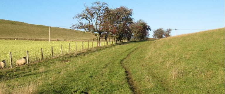
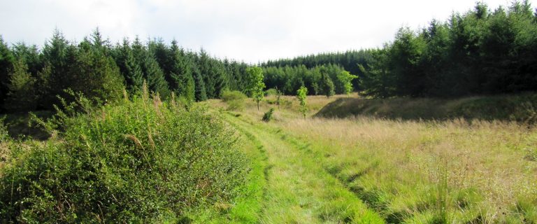
The Romans and Reivers route follows old Roman roads, forest tracks, drove roads and short sections of quiet lane through the heart of Reivers country. It provides enjoyable walking, cycling and horse riding through the Southern Uplands, mainly through sheltered woodland and forestry, with some sections across more open farmland. Developed specifically with multi-use in mind, including self-closing gates, it’s a great route for horse-riders with family or friends who want to accompany them on foot or mountain bikes.
Highlights
- Craik Roman signal station and other historical and archaeological interest directly on the route
- Samye Ling Tibetan Monastery near Eskdalemuir (also offers accommodation)
- sections of old drove road e.g. between Craik and Hawick
Be aware
- as of May 2025 some windblown trees are blocking the route at a few places in the Ae Forest; check for updates beforehand and take GPS if seeking an alternative route; allow extra time for extra distance
- in the Craik forest area, there is an overgrowth of Sitka spruce and some stumps – the authorities are working on this
- steep hill (about 200 m ascent in 750 m) between Garrogill and Dryer Water valley, east of Moffat; although this is a well-made path, you may need to lead your horse or push your bike
- majority of the route is on forest road or purpose built stone surfaced path.
- accommodation and other services are sparse
The challenge
Cutting east-west between the river valleys of the Southern Uplands, the Romans and Reivers route is a bit of a roller coaster, albeit gradients are never steep other than the section east of Garrogill. Part of the appeal is that although never far from civilisation, for much of the route you will feel as though you are in the middle of nowhere, and will pass very few villages. Sort out beforehand where you plan to stay, and take enough food to eat along the way. In 2025 there were problems in the Ae and Craik Forest areas: see above.
Accommodation
Wide range of shops, facilities, accommodation and services in Hawick and 1 mile off route in Moffat. B&Bs in Beattock, Eskdalemuir and Roberton. Accommodation near Craik Cross Hill at Craikhope Outdoor Centre. B&B plus horse and rider accommodation at Wiltonburn Farm and Meadshaw.
Support services
We don’t know of any dedicated to this route, although B&B hosts may offer baggage transfer and lifts to their walking guests. Or you could try local taxi firms.
Public transport
Regular bus services to Moffat and Hawick, and between Lockerbie and Eskdalemuir.
For details, visit Traveline Scotland, or, for the entire UK, Traveline. For travel from anywhere to anywhere, try Rome2Rio.