| Distance (km) | Ascent (metres) | Number of days | |
|---|---|---|---|
| 48 | 1060 | 2 - 4 | |
| Start: Cockburnspath | Finish: Berwick-upon-Tweed | ||
|
Linked to other Scotland’s Great Trail(s): John Muir Way Southern Upland Way |
|||
Books
Below we list printed maps and/or guidebooks in ascending order of cover price: click image or title for more info. To add or alter any items in this list, please Contact us.
Route type and direction
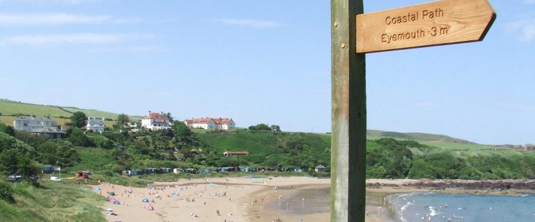
Linear: Cockburnspath to Berwick-upon-Tweed
Traditionally walked from north to south, mainly because Berwick makes a convenient terminus with its facilities and transport connections. If you prefer to walk northbound (Berwick to Cockburnspath) you are likely to have the prevailing wind at your back. From Cockburnspath you could follow the Forth to Farne Way (not an SGT) to Dunbar and North Berwick, joining the John Muir Way. Cockburnspath is also on the Southern Upland Way.
Overview
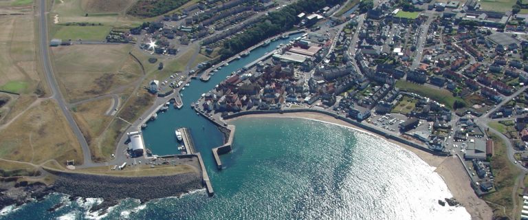
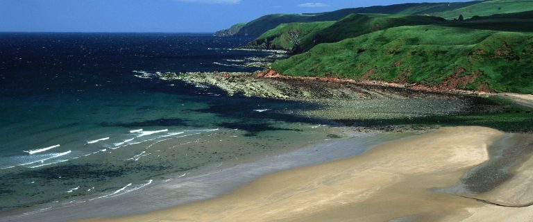
This trail follows one of the most spectacular coastlines in Britain, passing above impressive cliffs, including the 103-metre cliffs at Fancove Head. The route offers splendid views of sea arches, stacks and old forts. Its appeal goes beyond glorious scenery, with areas of international importance for seabirds, coastal grasses and wildflowers, and marine life. There is also human history in the fishing villages, including the 1881 disaster near Eyemouth in which 189 fishermen lost their lives. The geology of this coastline is visible and important: some will wish to detour to Siccar Point, the site of a famous Unconformity noted in 1788 by geologist James Hutton. Cockburnspath is the eastern terminus of the Southern Upland Way and the southern end of the 10-mile (16-km) John Muir Link. The Forth to Farne Way is a route from North Berwick to Lindisfarne which follows the entire length of the BCP.
Highlights
- views over rural landscapes of East Lothian and the Borders
- historic border town of Berwick-upon-Tweed with its fortified walls
- rugged coastal scenery with spectacular cliffs
- Coldingham Bay with its glorious beach
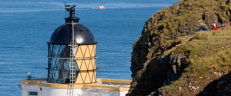
- National Nature Reserve at St Abbs Head (short detour)
- fishing villages with lots of character
Be aware
- some road walking
- care needed on unprotected cliff edges
- no accommodation in Cockburnspath
The challenge
The route’s considerable altitude gain makes it surprisingly strenuous: don’t underestimate the challenge because of its modest length. The gradients vary: some paths are easy, others very steep. The terrain is also mixed, with rocky sections and sandy beaches as well as constructed footpaths. Aim to spend at least three days on the trail, albeit strong, experienced walkers may prefer to complete it in two. For a leisurely pace, you could extend it to four days, using local buses to travel to, and return from, each day’s start and finish. Waymarking is generally good but gives out as you enter Berwick.
Accommodation
There is a range of accommodation around Coldingham and Eyemouth, and a wide range in Berwick-upon-Tweed, but none in Cockburnspath. For listings, try VisitScotland.
Support services
The following companies offer self-guided packages for the Berwickshire Coastal Path:
Public transport
Berwick-upon-Tweed is on the east coast mainline, and is linked with Edinburgh by Borders Buses, which also serves Cockburnspath and other points along the coast, roughly hourly.
The nearest airports are at Edinburgh and Newcastle upon Tyne.
For details, visit Traveline Scotland, or, for the entire UK, Traveline. For travel from anywhere to anywhere, try Rome2Rio.
Download the Berwickshire Coastal Path leaflet
| Berwickshire Coastal Path (BCP) leaflet | Download |